Baralacha La Pass: Location, State, Distance, and UPSC Relevant Facts
Share

Baralacha La Pass is a high-altitude mountain pass in the Himalayas that plays an important role in Indian geography and is frequently asked in UPSC examinations. Situated on the Manali Leh Highway, the pass connects the Lahaul region of Himachal Pradesh with Ladakh and holds significance due to its altitude, river origins, and strategic connectivity.
Here we explain all major aspects of Baralacha La Pass UPSC, including its location, the state in which it lies, the distance from Keylong, and its relevance when compared with the highest passes in India.
Baralacha La UPSC Overview
Baralacha La Pass lies in the Zanskar range of the Himalayas. The term “La” in Tibetan means pass, which is commonly used in the names of Himalayan mountain passes. Baralacha La forms an important geographical feature along the Manali–Leh road corridor.
For UPSC aspirants, the pass is important due to its:
-
Location in the western Himalayas
-
Proximity to Ladakh
-
Role in connecting multiple river systems
-
Frequent appearance in mapping-based questions
Baralacha Pass in Which State?
A commonly asked question in competitive examinations is: Baralacha Pass is located in which state?
Baralacha La Pass is located in Himachal Pradesh, specifically in the Lahaul and Spiti district. Although it lies close to the border of Ladakh, it does not fall within Ladakh’s administrative boundaries.
This distinction is important, as many aspirants mistakenly assume Baralacha La Pass lies in Ladakh.
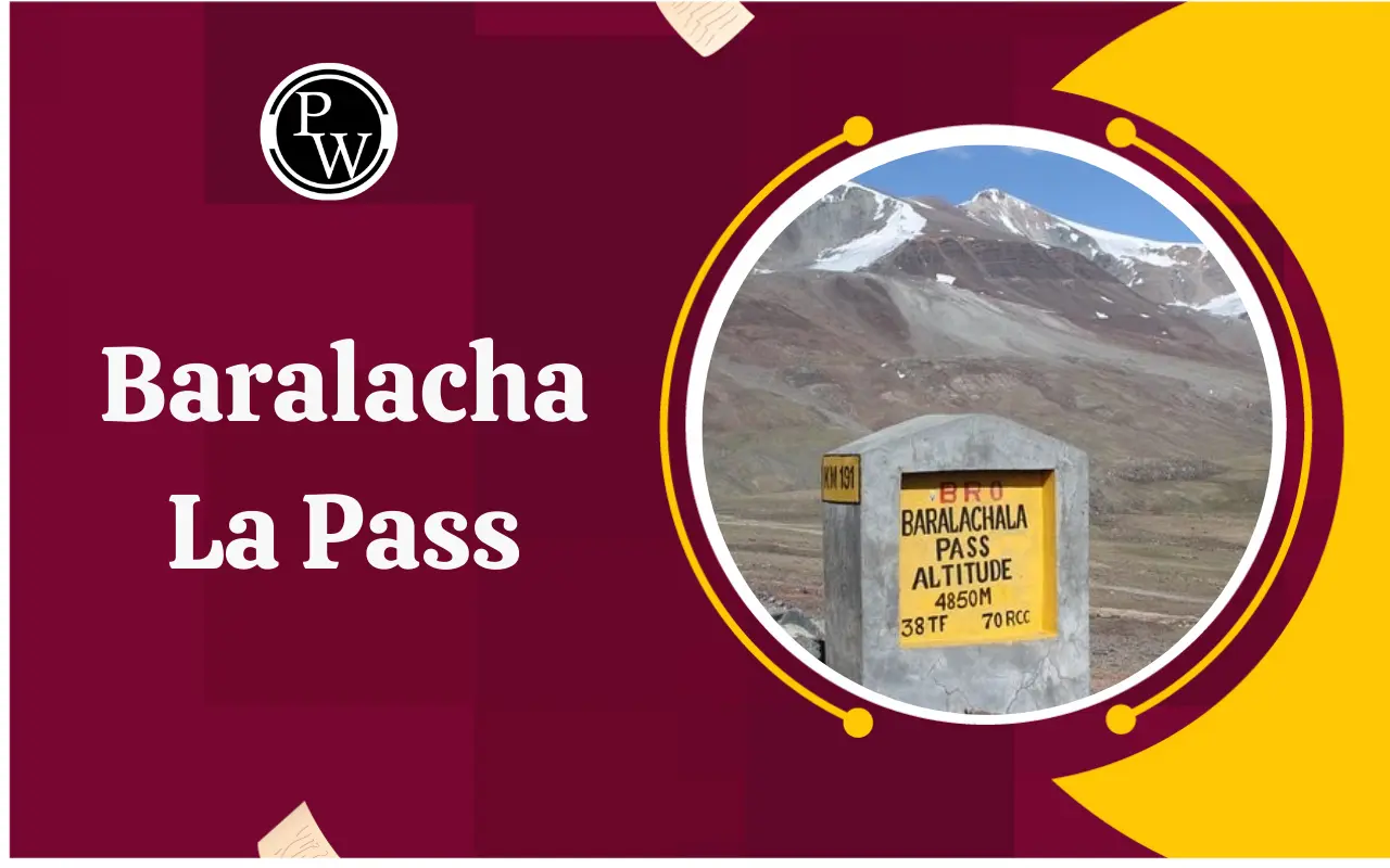
Baralacha La Pass: Altitude and Physical Features
Baralacha La Pass is situated at an altitude of approximately 4,890 metres (about 16,040 feet) above sea level. Due to its high elevation, the region experiences extreme cold, heavy snowfall, and harsh climatic conditions for most of the year.
The pass remains open only during the summer months, usually from June to October, depending on weather conditions. During winter, heavy snow blocks the route completely.
Rivers Originating Near Baralacha La Pass
One of the most important geographical features of Baralacha La Pass is that it lies near the source region of several rivers. This makes it especially relevant for UPSC Prelims.
The following rivers originate near Baralacha La Pass:
-
Bhaga River, which flows through Himachal Pradesh
-
Chandra River, which later joins the Bhaga to form the Chenab
-
Yunam River, which flows towards Ladakh
Due to this, Baralacha La Pass is considered a triple watershed region.
Keylong to Baralacha Pass Distance
Keylong, the administrative headquarters of Lahaul and Spiti district, is the nearest major town to Baralacha La Pass.
-
Keylong to Baralacha Pass distance: approximately 75–80 kilometres
-
Average travel time: 3 to 5 hours, depending on road and weather conditions
The route from Keylong to Baralacha La is part of the Manali–Leh Highway and passes through rugged mountainous terrain.
Strategic Importance of Baralacha La Pass
Although Baralacha La Pass is not located directly on an international border, it holds considerable strategic importance. It serves as a critical link between Himachal Pradesh and Ladakh and supports the movement of goods, tourists, and defence-related logistics.
The pass contributes to:
-
Improved connectivity to remote Himalayan regions
-
Strengthening of infrastructure in high-altitude areas
-
Disaster relief and emergency transportation
These aspects make it relevant for both General Studies Paper I and Paper III.
Baralacha La Pass and the Highest Pass in India
Another frequently tested area in UPSC exams is the comparison between Baralacha La Pass and the highest mountain passes in India.
Baralacha La Pass is not the highest pass in India. The title of the highest motorable pass in India belongs to Umling La Pass in Ladakh, which is located at a much higher altitude.
Other high passes in India include:
-
Khardung La
-
Marsimik La
Baralacha La remains important due to its location and connectivity rather than its altitude ranking.
Comparison with Other Himalayan Passes
Baralacha La Pass is often compared with other passes in the western Himalayas such as Rohtang Pass and Khardung La. While Rohtang Pass connects Manali to Lahaul Valley, Baralacha La extends this connectivity further towards Ladakh.
Understanding the relative location of these passes helps in solving map-based and matching questions in UPSC Prelims.
Environmental Conditions and Challenges
The region around Baralacha La Pass is ecologically fragile. The area faces challenges such as:
-
Heavy snowfall and avalanches
-
Short working season for road construction
-
Effects of climate change on glaciers
-
Increased pressure due to tourism
These points are useful for answer writing in Mains, especially in questions related to Himalayan ecology and sustainable development.
Importance of Baralacha La Pass in UPSC Preparation
Baralacha La Pass is repeatedly asked in UPSC examinations because it combines:
-
Physical geography
-
Indian mapping
-
Strategic connectivity
-
River systems
A clear understanding of its location, associated rivers, and comparative importance helps aspirants score well in both Prelims and UPSC Mains.
Frequently Asked Questions
Baralacha La Pass is located in which state?
Is Baralacha La Pass the highest pass in India?
Why is Baralacha La Pass important for UPSC?
What is the distance from Keylong to Baralacha Pass?