
Global Navigation Satellite System: Types, Features, Importance and Comparison

Understanding how we pinpoint locations on Earth is key in today's world is important. The Global Navigation Satellite System (GNSS) makes this possible. It guides everything from our phones to global transport. It explains GNSS, its types, and its wide-ranging uses, helping you grasp this vital technology. Accurate positioning is crucial for many modern applications.
Global Navigation Satellite System Overview
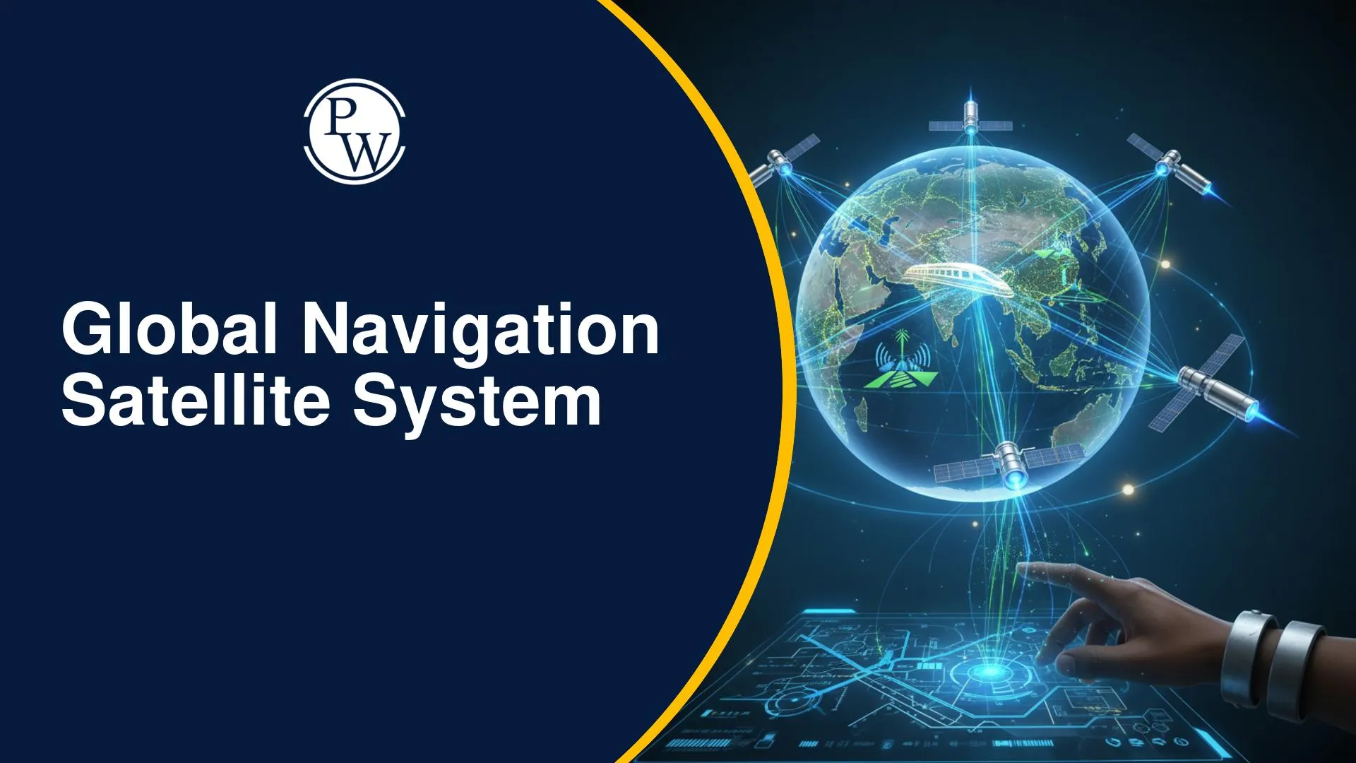
A Global Navigation Satellite System (GNSS) is a space-based technology. It offers accurate positioning, navigation, and precise timing. GNSS relies on Earth-orbiting satellites, ground control, and special receivers. These systems allow users to find their exact location anywhere on Earth. They are crucial for many aspects of modern life and competitive exam knowledge.
The following table provides a concise summary of Global Navigation Satellite System technology, integrating key technical details with the specific navigation satellite constellations used worldwide.
|
Global Navigation Satellite System Overview |
|
|
Feature |
Details |
|
GNSS Full Form |
Global Navigation Satellite System |
|
Core Definition |
A space-based navigation system providing global or regional positioning, navigation, and timing (PNT). |
|
Operating Principle |
Trilateration technique GNSS; receivers calculate distance from at least four satellites to determine 3D position and time. |
|
Global Positioning Technology |
GPS (USA), GLONASS (Russia), Galileo (Europe), and BeiDou (China). |
|
Regional Systems |
NavIC / IRNSS (India) and QZSS (Japan). |
|
IRNSS Features India |
Focuses on the Indian landmass and 1,500 km beyond; uses a unique satellite orbit navigation system (7 satellites in GEO/GSO). |
|
GNSS Accuracy and Signals |
Reliability is maintained by the International GNSS Service (IGS); signals are used for precision in GNSS in agriculture and surveying. |
|
Transport Innovation |
Powering GNSS in transportation systems and the upcoming GNSS based electronic toll collection India. |
|
Future Toll System |
The FASTag GNSS system India will replace physical booths with distance-based satellite tracking. |
|
Modern Importance |
Essential for geospatial positioning technology, telecommunications, and synchronized satellite based timing systems. |
Global Navigation Satellite System Types
Global Navigation Satellite System platforms include several global and regional systems. Each has unique features and orbital structures. They all offer positioning services worldwide.
GPS (Global Positioning System)
This system belongs to the United States. It includes 24 satellites in orbit at 20,200 km. These satellites provide global positioning. At least six satellites are almost always visible from any point on Earth.
GLONASS (Russian Federation)
Russia operates the GLONASS system. It has 24 active satellites. These satellites orbit at 19,140 km. GLONASS offers reliable navigation services globally.
Galileo (European System)
Europe's Galileo system began operations in 2016. It plans for 30 satellites, including spares. These satellites are positioned at 23,222 km. Galileo enhances navigation accuracy.
BeiDou Navigation System China
China developed the BeiDou system. It has 35 satellites with various orbits. This complex constellation ensures global coverage. It provides enhanced positioning capabilities.
NavIC India Navigation System (IRNSS)
India's IRNSS, also called NavIC, is a regional system. It uses geosynchronous satellites at 20,650 km. NavIC provides accurate real-time positioning in India and nearby areas.
QZSS (Japan)
Japan's Quasi-Zenith Satellite System is a regional network. It has four satellites. QZSS improves GPS accuracy in Asia-Oceania, especially in difficult terrains.
Global Navigation Satellite System Features
Global Navigation Satellite System technology relies on several key features. These include satellite networks and signal processing. They provide accurate positioning, navigation, and timing services.
Satellite Constellations
GNSS uses many satellites orbiting Earth. They continuously broadcast their location and time. This allows receivers to determine exact geographic positions.
Trilateration Technique GNSS
GNSS receivers calculate positions using trilateration. They measure distances from multiple satellites. This technique ensures high accuracy. Signal quality and receiver capabilities affect precision.
Multi-system Interoperability
Systems like GPS, GLONASS, Galileo, and BeiDou can work together. A single receiver can access signals from many constellations. This improves positioning accuracy. It is especially useful in urban or mountainous areas.
GNSS Ground Control Stations
GNSS relies on global ground control networks. These stations monitor and process satellite data. They maintain the system's accuracy and reliability.
Satellite Communication and Navigation
Satellites transmit signals using radio frequency carriers. Receivers decode these signals. This process computes positions with varying precision.
International GNSS Service (IGS)
The IGS provides global data from hundreds of stations. This data supports scientific and geophysical research. It ensures the accuracy and consistency of GNSS products.
Global Navigation Satellite System Importance
Global Navigation Satellite System technology is critical for modern life. It supports many sectors and provides precise data.
GNSS plays an important role in transportation systems. It guides aviation, maritime, rail, road, and space vehicles. This ensures safe and efficient movement. Its use in autonomous vehicles is growing.
GNSS timing signals are essential for infrastructure. They synchronize telecommunications and manage power grids. They also control computer networks, ensuring stability. This makes GNSS a satellite based timing system.
Scientific research greatly benefits from high-accuracy GNSS data. It helps study tectonic plate movements and earthquake displacements. GNSS aids in understanding Earth's orientation. These are key for geophysical and environmental studies. For students and aspirants, understanding these applications highlights the interdisciplinary nature of physics and technology.
Economically, GNSS supports finance, mining, agriculture, and surveying. It allows for precise measurements and better decision-making. GNSS applications in India include efficient toll collection. The NHAI’s GNSS based ETC system calculates tolls based on distance travelled. This reduces traffic congestion and modernizes toll infrastructure. This is a crucial area for competitive exams, especially those focusing on current affairs and technology policy.
The Evolution of Global Positioning Technology
When we ask, "what is Global Navigation Satellite System?", we are looking at the peak of global positioning technology. In the past, sailors used stars for navigation; today, we use a space-based navigation system. This shift has changed everything from how we order food to how disaster relief teams find survivors. The transition from simple maps to geospatial positioning technology means that we no longer just see a "place"—we see precise coordinates in real-time.
Navigation Systems Comparison
Understanding a navigation systems comparison helps students see how different nations compete and collaborate in space. While we often hear GPS vs GLONASS vs Galileo, it is important to know that they aren't just "clones" of each other.
-
GPS was the pioneer, but Galileo offers higher precision for civilian use.
-
GLONASS provides better coverage in northern latitudes (like Russia).
-
IRNSS features India-specific advantages, such as the use of dual-frequency bands (L5 and S-band), which makes NavIC more accurate in the humid, tropical conditions of the Indian subcontinent compared to single-band GPS.
GNSS: Powering Industry and Infrastructure
The GNSS importance in modern technology extends into the very foundation of our economy:
-
GNSS in Transportation Systems: Beyond Google Maps, it allows for "Automatic Dependent Surveillance-Broadcast" (ADS-B) in aviation, helping planes fly closer together safely, reducing fuel and time.
-
GNSS in Agriculture and Surveying: In rural India, this technology is used for "soil health mapping" and land record digitization. Surveyors use GNSS to define property boundaries with centimetre-level accuracy, preventing land disputes.
-
Scientific Accuracy: The International GNSS Service (IGS) acts as a global watchdog, ensuring that GNSS accuracy and signals remain consistent. This data is used by scientists to monitor how the Earth’s crust shifts after an earthquake.
The Future: FASTag GNSS System in India
The most exciting update for Indian students is the transition toward a GNSS-based electronic toll collection India model. While the current FASTag requires physical scanners at booths, the upcoming FASTag GNSS system India will turn the entire highway into a virtual toll zone.
By using a satellite orbit navigation system, the government can track when a vehicle enters and exits a highway, deducting the toll automatically. This is a perfect example of how a satellite positioning system moves from being a "military tool" to a "daily life convenience."
Global Navigation Satellite System FAQs
Q1. What is a Global Navigation Satellite System (GNSS)?
Q2. Which are the major Global Navigation Satellite System (GNSS) systems in the world?
Q3. How does the Global Navigation Satellite System determine location?
Q4. What is GNSS based Electronic Toll Collection (ETC)?
Q5. What is the role of satellites in the Global Navigation Satellite System?