

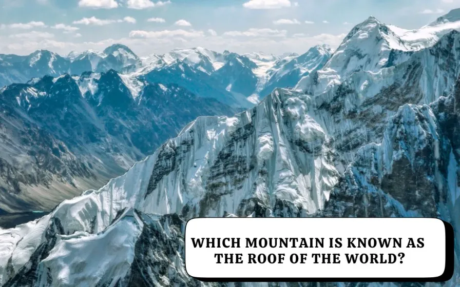
Which Mountain is Known as the Roof of the World?

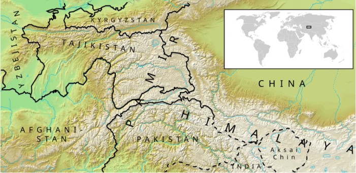
The Pamir Mountains, known in Persian as “Bam-i-Duniya”, literally translate to the “Roof of the World.” These towering highlands are located mainly in Tajikistan, extending into Afghanistan, China, and Kyrgyzstan. The Pamirs form the central junction of Asia’s greatest ranges — the Himalayas, Karakoram, Hindu Kush, Kunlun, and Tian Shan, earning their global title as one of Earth’s most elevated regions.
Why Are the Pamir Mountains Called the Roof of the World?
The Pamirs are called the Roof of the World because of their average altitude of 4,000 meters (13,000 ft), with peaks soaring above 7,000 meters (23,000 ft).
Early Silk Road travelers and explorers marveled at these heights where the sky appears closest to the Earth. The name also reflects the Pamirs’ role as the geographical heart of Asia, where the world’s mightiest mountain systems converge.
Where Are the Pamir Mountains Located?
The Pamirs lie in eastern Tajikistan’s Gorno-Badakhshan Autonomous Province, reaching into Afghanistan’s Wakhan Corridor, China’s Xinjiang, and Kyrgyzstan.
This high-altitude region serves as a strategic link between Central and South Asia, featuring vast valleys, icy passes, and rugged peaks that shaped ancient trade routes and cultural exchanges.
Also Read: How Many Countries Have No Rivers?
The Highest Peak in the Pamir Mountains
The highest summit in the Pamirs is Ismoil Somoni Peak (7,495 m), formerly called Communism Peak.
It honors Ismoil Somoni, the founder of the first Persian Empire in Central Asia.
Other notable peaks include Independence Peak (7,134 m) and Kaufman Peak (6,723 m)—all contributing to the Pamirs’ majestic skyline.
Historical Background of the Name “Roof of the World”
The title “Roof of the World” has ancient Persian and Central Asian roots. During the 19th century, Western explorers adopted it to describe the Pamir Plateau’s immense altitude and isolation.
Historically, this region symbolized both the physical and spiritual high point of Asia, where many of the continent’s great rivers originate.
Climate and Geography
The Pamirs experience an alpine climate with long, frigid winters and short, cool summers.
Temperatures often fall below –40°C, and the peaks remain snow-covered throughout the year.
The region houses the Fedchenko Glacier, stretching over 77 km, making it the largest glacier outside the polar regions.
Interesting Facts About the Pamir Mountains
-
Bam-i-Duniya – The Persian name meaning “Roof of the World” reflects its sky-high elevation.
-
Meeting Point of Great Ranges – The Pamirs unite five of Asia’s grandest mountain systems.
-
Home to the Fedchenko Glacier – The world’s largest non-polar glacier is found here.
-
Ancient Silk Route – The Pamirs were a vital trade link connecting East and West.
-
High-Altitude Settlements – Villages here sit above 3,500 meters, among the highest on Earth.
Relevance for UPSC Aspirants
For UPSC Geography and Current Affairs, the Pamir Mountains often appear in questions related to:
-
Physical geography of Asia
-
Strategic locations and international borders
-
Glacial systems and river origins
-
Historical trade routes (Silk Road)
Remember, the Pamirs’ geographical significance extends beyond altitude — it represents a hub of cultural, climatic, and geopolitical convergence in Asia.
FAQs
Which mountain range is called the Roof of the World?
What does “Bam-i-Duniya” mean?
Where are the Pamir Mountains located?
What is the highest peak in the Pamir Mountains?
Why are the Pamirs important for geography students?