Floods In Bihar 2024, Most Flood-Affected Areas, Causes
Floods In Bihar: Floods in Bihar state are a reoccurring and devastating natural disaster, making this state India's most flood-prone state. Approximately 76% of the North Bihar Population lives under the constant threat of flood, this issue has serious socio-economic and environmental consequences. Bihar contributed 16.5% of India's flood-affected area and contains 22.1% of the country's flood-affected population. We have created this blog, to provide insights and overview on Floods in Bihar 2024, their historical background, flood-prone areas in Bihar, and the effects of floods in Bihar. This blog also discusses which river causes flooding in Bihar and the primary causes behind this persistent problem.
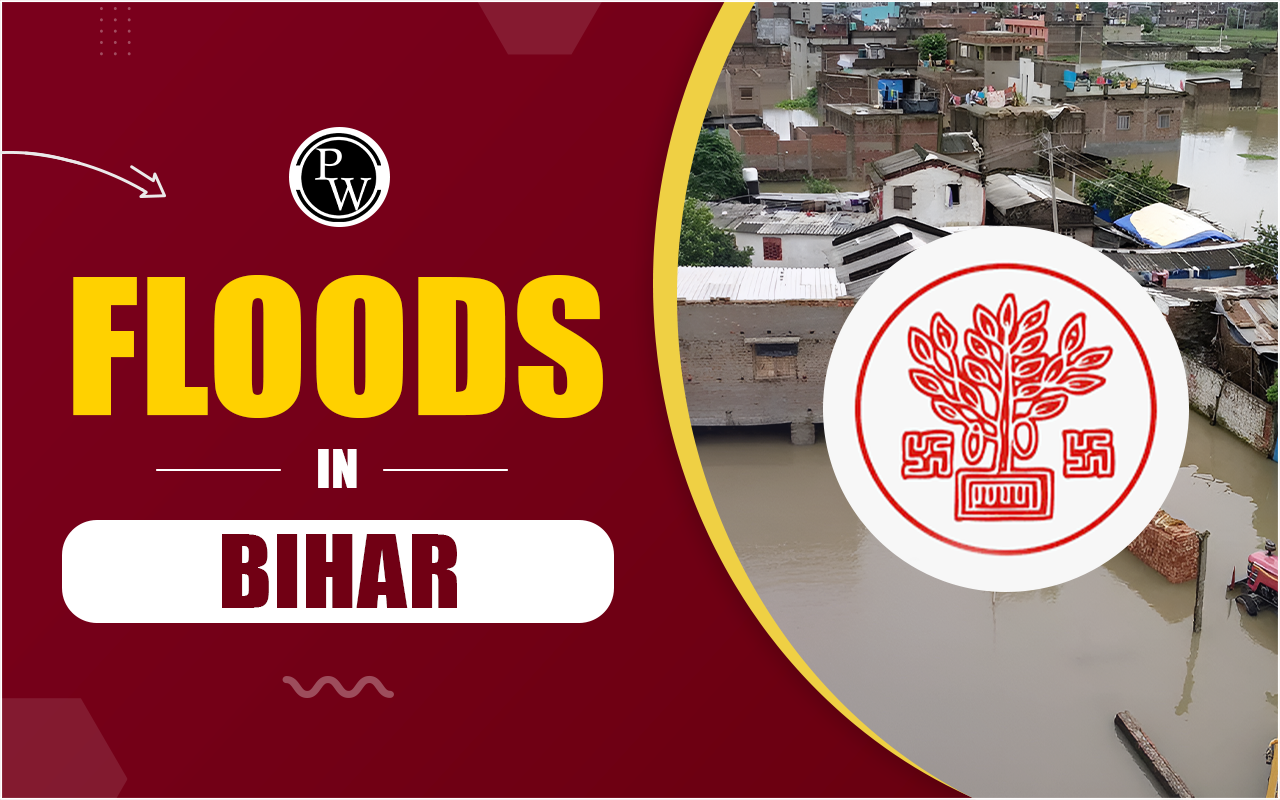
Floods in Bihar
Bihar is majorly impacted by floods, particularly during the monsoon season from June to September . Floods in Bihar affect 73.06% of the state's total geographical area, equal to 68,800 square kilometres out of its total 94,160 square kilometres . Facing recurring floods in Bihar has resulted in the loss of human lives, destruction of livestock, and damage to millions of properties. Since 1979, floods in Bihar have claimed around 9,500 lives.
In Floods in Bihar 2024, the northern districts of Bihar once again faced large-scale devastation due to overflowing rivers and heavy rainfall. The most flood-affected areas in Bihar included districts such as Muzaffarpur, Darbhanga, and Supaul, with thousands of people displaced and extended agricultural lands submerged.| Floods in Bihar | |
|---|---|
| Category | Details |
| Geographical Location | Bihar is located in the eastern part of India. |
| Main Causes of Floods |
|
| Rivers Prone to Floods | Kosi (often called the "Sorrow of Bihar"), Ganga, Gandak, Bagmati, Burhi Gandak. |
| Affected Areas | North Bihar (districts like Muzaffarpur, Darbhanga, Supaul, Saharsa, Madhubani, Sitamarhi, Purnea). |
| Annual Rainfall | Around 1200–1700 mm, with most rainfall concentrated during the monsoon season (June to September). |
| Impact on Population |
|
| Economic Impact | Significant agricultural losses, infrastructure damage, and economic strain on the state’s resources. |
| Relief Measures | Evacuation, relief camps, distribution of food and medical supplies, rescue operations by NDRF, SDRF. |
| Government Initiatives | Flood management programs, construction of embankments, flood forecasting systems, disaster relief funds. |
| Long-term Solutions | River interlinking projects, afforestation, improving drainage systems, and silt removal from rivers. |
Which River Causes Floods in Bihar?
The rivers in Bihar, especially in the northern region are a significant factor in floods. The major rivers responsible for floods in Bihar are:- Kosi River
- Mahananda River
- Bagmati River
- Burhi Gandak River
- Gandak River
Flood Prone Areas in Bihar
Flood-prone areas in Bihar are vast and include both the northern and southern regions. However, North Bihar remains the most vulnerable, with multiple rivers flowing through this region, originating from Nepal . Some of the districts that are regularly target of the floods in Bihar are given below:
- Muzaffarpur
- Sitamarhi
- Darbhanga
- Supaul
- Madhubani
- Saharsa
- Khagaria
- East Champaran
- West Champaran
| Flood Inundation Areas in Part of Bihar State |
| Click Here |
Floods in Bihar History
Floods in Bihar history consist of floods that have been a regular occurrence for many centuries, but in recent decades there has been a threatening increase in the frequency and intensity of floods in Bihar . The biggest flood in Bihar occurred in 2008 , when the Kosi River submerged, its barricade at Kusaha in Nepal , flooding a vast area while affecting over 3 million people. The flood was one of the worst disasters for Bihar, because of which more than a million people have been displaced and destroying property and livelihoods.
In 2013 , floods in Bihar affected over 5.9 million people across 3,768 villages in 20 districts. In 2017 , a particularly powerful flood smashed and submerged North Bihar , killing 514 people and affecting over 17 million across 19 districts.| Damages in Bihar Due to Flood (1979–2006) | |||||||||||
|---|---|---|---|---|---|---|---|---|---|---|---|
| Year | Districts | Blocks | Panchayats | Villages | Humans (100,000) | Animals (100,000) | Total Area (100,000 ha) | Farmed Areas (100,000 ha) | Crop Damage (100,000 INR) | Houses Damaged | Public Property Damaged (100,000 INR) |
| 2006 | 14 | 63 | 375 | 959 | 10.89 | 0.1 | 1.81 | 0.87 | 706.63 | 18,637 | 8,456.17 |
| 2005 | 12 | 81 | 562 | 1,464 | 21.04 | 5.35 | 4.6 | 1.35 | 1,164.50 | 5,538 | 305 |
| 2004 | 20 | 211 | 2,788 | 9,346 | 212.99 | 86.86 | 27 | 13.99 | 52,205.64 | 929,773 | 103,049.60 |
| 2003 | 24 | 172 | 1,496 | 5,077 | 76.02 | 11.96 | 15.08 | 6.1 | 6,266.13 | 45,262 | 1,035.16 |
| 2002 | 25 | 6 | 2,504 | 8,318 | 160.18 | 52.51 | 19.69 | 9.4 | 51,149.61 | 419,014 | 40,892.19 |
| 2001 | 22 | 194 | 1,992 | 6,405 | 90.91 | 11.7 | 11.95 | 6.5 | 26,721.79 | 222,074 | 18,353.78 |
| 2000 | 33 | 213 | 2,327 | 12,351 | 90.18 | 8.09 | 8.05 | 4.43 | 8,303.70 | 343,091 | 3,780.66 |
| 1999 | 24 | 150 | 1,604 | 5,057 | 65.66 | 13.58 | 8.45 | 3.04 | 24,203.88 | 91,813 | 5,409.99 |
| 1998 | 28 | 260 | 2,739 | 8,347 | 134.7 | 30.93 | 25.12 | 12.84 | 36,696.68 | 199,611 | 9,284.04 |
| 1997 | 26 | 169 | 1,902 | 7,043 | 69.65 | 10.11 | 14.71 | 6.55 | 5,737.66 | 174,379 | 2,038.09 |
| 1996 | 29 | 195 | 2,049 | 6,417 | 67.33 | 6.6 | 11.89 | 7.34 | 7,169.29 | 116,194 | 1,035.70 |
| 1995 | 26 | 177 | 1,901 | 8,233 | 66.29 | 8.15 | 9.26 | 4.24 | 19,514.32 | 297,765 | 2,183.57 |
| 1994 | 21 | 112 | 1,045 | 2,755 | 40.12 | 15.03 | 6.32 | 3.5 | 5,616.33 | 33,876 | 151.66 |
| 1993 | 18 | 124 | 1,263 | 3,422 | 53.52 | 6.68 | 15.64 | 11.35 | 13,950.17 | 219,826 | 3,040.86 |
| 1992 | 8 | 19 | 170 | 414 | 5.56 | 0.75 | 0.76 | 0.25 | 58.09 | 1,281 | 0.75 |
| 1991 | 24 | 137 | 1,336 | 4,096 | 48.23 | 5.13 | 9.8 | 4.05 | 2,361.03 | 27,324 | 139.93 |
| 1990 | 24 | 162 | 1,259 | 4,178 | 39.57 | 2.7 | 8.73 | 3.21 | 1,818.88 | 11,009 | 182.27 |
| 1989 | 16 | 74 | 652 | 1,821 | 18.79 | 0.35 | 4.71 | 1.65 | 704.88 | 7,746 | 83.7 |
| 1988 | 23 | 181 | 1,616 | 5,687 | 62.34 | 0.21 | 10.52 | 3.95 | 4,986.32 | 14,759 | 150.64 |
| 1987 | 30 | 382 | 6,112 | 24,518 | 286.62 | 33.25 | 47.5 | 25.7 | 67,881.00 | 1,704,999 | 680.86 |
| 1986 | 23 | 189 | 1,828 | 6,509 | 75.8 | - | 19.18 | 7.97 | 10,513.51 | 136,774 | 3,201.99 |
| 1985 | 20 | 162 | 1,245 | 5,315 | 53.09 | - | 7.94 | 4.38 | 3,129.52 | 103,279 | 204.64 |
| 1984 | 23 | 239 | 3,209 | 11,154 | 135 | - | 30.5 | 15.87 | 18,543.85 | 310,405 | 2,717.72 |
| 1983 | 22 | 138 | 1,224 | 4,060 | 42.41 | - | 18.13 | 5.78 | 2,629.25 | 38,679 | 258.14 |
| 1982 | 15 | 110 | 1,112 | 3,708 | 46.81 | 45.14 | 9.32 | 3.23 | 9,700.00 | 68,242 | 955.33 |
| 1981 | 21 | 201 | 2,138 | 7,367 | 69.47 | 74.83 | 12.61 | 7.71 | 7,213.19 | 75,776 | - |
| 1980 | 21 | 193 | 1,869 | 7,010 | 74.45 | - | 17.86 | 9.43 | 7,608.43 | 118,507 | - |
| 1979 | 13 | 110 | - | - | 37.38 | - | 8.06 | 2.74 | 1,901.52 | 27,816 | - |
Causes of Floods in Bihar
Multiple factors contribute to the reoccurring floods in Bihar :1. Geographical Location
Bihar's location in the Gangetic plains, with many rivers flowing down from the Himalayas, makes it naturally vulnerable to floods. The state's flat topography slows the drainage of floodwaters, which deepens the chances of flooding.2. Heavy Monsoonal Rains
Bihar experiences extreme rainfall during the monsoon season, which often leads to rivers overflowing their banks. The state's proximity to the Himalayas means that it receives the outflow from rivers that originate in Nepal, adding to the water volume.3. Sedimentation in Rivers
Rivers like the Kosi and Gandak carry massive amounts of sediment from the mountains. Over time, the sediment builds up, raising the riverbeds and reducing their water-carrying capacity, leading to breaches and floods.4. Weak Embankments
Bihar's rivers are surrounded by barriers to prevent flooding. However, many of these embankments are weak or poorly maintained, causing them to collapse under the pressure of floodwaters.5. Deforestation and Soil Erosion
The deforestation in the flood-prone areas leads to faster soil erosion and sedimentation of rivers, deepening the flood situation.6. Climate Change
Recent changes in weather patterns and changes in global climate have resulted in more intense and unpredictable rainfall, which contributes to more extreme floods.Effects of Floods in Bihar
The effects of floods in Bihar are across the state and devastating, they impact the economy, environment, and social structure of Bihar.1. Loss of Lives and Livelihoods
Floods in Bihar lead to a hike in death rate every year and on the other hand, displacing thousands of people from their homes. With most of the population engaged in agriculture, floods destroy crops and lead to significant loss of income for farmers, which gives birth to poverty.2. Damage to Infrastructure
Roads, bridges, schools, hospitals, and homes are often destroyed during floods. The cost of repairing this infrastructure costs millions to the government of Bihar, which creates pressure on government resources.3. Health Hazards
Floodwaters become breeding grounds for diseases like cholera , dysentery , and malaria . The lack of access to clean drinking water and healthcare services further deteriorates the situation.4. Environmental Degradation
Floods erode the topsoil and damage fertile land, which duly affects agricultural productivity. Deforestation and soil erosion also lead to further degradation of the environment.5. Migration and Displacement
Reoccurring floods force people to migrate from rural areas to urban centres in search of jobs and better living conditions, creating social challenges and overcrowding in cities.The Biggest Flood in Bihar
The biggest flood in Bihar occurred in 2008 when the Kosi River reached to its embankment, which resulted in a massive disaster that affected more than 3.3 million people . The flood displaced around a million individuals , destroyed homes, and caused long-lasting damage to the state's infrastructure and agriculture.Mitigation Strategies for Floods in Bihar
According to the reoccurring nature of floods in Bihar , implementing effective mitigation strategies is essential to reduce their devastating impacts. These strategies include a combination of structural and non-structural measures, improved disaster management, and sustainable environmental practices.1. Strengthening and Maintenance of Embankments
One of the primary reasons for floods in Bihar is the failure of embankments along major rivers. Regular monitoring, timely repairs, and reinforcement of these embankments are required. Flood-resistant embankments using modern materials and technologies can provide better protection during monsoons.2. Dredging and Desiltation of Rivers
Rivers in Bihar carry heavy sediment loads from the Himalayas, leading to siltation and raised riverbeds. Regular dredging and desolation of rivers like the Kosi, Gandak, and Bagmati can help increase their water-carrying capacity and prevent breaches.3. Improved Flood Forecasting and Early Warning Systems
Developing and utilizing advanced flood forecasting systems using satellite imagery, meteorological data, and hydrological models can provide early warnings to the population. Early warning systems allow authorities and people to evacuate and prepare for floods, minimizing loss of life and property.4. Building Flood-Resilient Infrastructure
Constructing flood-resistant infrastructure, including elevated roads, bridges, and houses, especially in flood-prone areas in Bihar , can help reduce damage during floods. New constructions in vulnerable areas should be made following flood-resilient building codes.5. Construction of Barrages and Dams
constructing more dams and barrages on Bihar's major rivers can help regulate water flow during the monsoon. By controlling the release of water, these structures can mitigate the impact of excessive rainfall. Moreover, they can store water for use during dry periods, balancing the state's water needs.Floods in Bihar FAQs
Q.1 Which river causes flood in Bihar?
Q.2 What are the most flood-affected areas in Bihar?
Q.3 What are the effects of floods in Bihar?
Q.4 What are the main causes of floods in Bihar?
Q.5 What is the history of floods in Bihar?