Fluvial Landforms Meaning, Processes, Types, Diagram and Examples

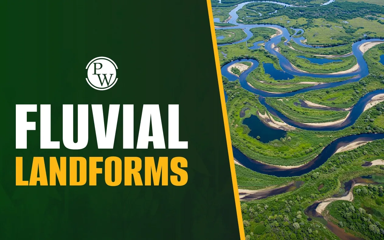
Fluvial landforms are features on the Earth's surface that are shaped primarily by the action of rivers and streams. Over time, rivers erode, transport, and deposit materials. This continuous movement shapes the Earth’s surface in many ways, creating fluvial landforms. Fluvial landforms play a key role in ecosystems, agriculture, and human settlement patterns.
Fluvial Landforms Meaning
Fluvial landforms are natural features created by the movement of rivers and streams. The word “fluvial” comes from the Latin word fluvialis, which means "river". These landforms result from three main river processes: erosion, transportation, and deposition.
When rivers flow over land, they erode the soil and rocks in their path. The eroded material is carried downstream. Later, this material gets deposited in different places. This entire process shapes the land. From valleys to floodplains, many features owe their origin to rivers.
Fluvial landforms tell about the river’s journey from its youthful stage in the mountains to its mature stage on plains, and finally to its old stage near the mouth.
Also Read: Aeolian Landforms
Fluvial Landforms Formation Process
Fluvial landforms form through long-term interaction between running water and land. The process mainly involves three steps: erosion, transportation, and deposition.
-
Erosion: Rivers cut into the land as they flow. This happens due to hydraulic action, abrasion, attrition, and solution. Fast-moving rivers in hilly areas erode land quickly.
-
Transportation: The eroded material is transported downstream. It moves as bedload (rolling and sliding), suspended load (floating particles), or in solution (dissolved minerals).
-
Deposition: When the river slows down, it starts depositing the carried material. This happens in low-lying areas like plains and deltas. Deposition creates landforms such as levees, deltas, and alluvial fans.
The type of fluvial landform depends on the stage of the river. Youthful rivers create features like waterfalls and V-shaped valleys. Mature rivers build floodplains. Old rivers form features like oxbow lakes and deltas.
Types of Fluvial Landforms
Fluvial landforms are mainly divided into three types based on the river’s activity: erosional, depositional, and erosional-cum-depositional landforms.
1. Erosional Landforms
These are formed by the removal of soil and rocks by river action. They are common in the upper course of the river where it flows fast.
V-Shaped Valleys: These valleys have steep sides and a narrow floor. Rivers cut deep into the land, forming a "V" shape.

Waterfalls: Formed where a river flows over a steep edge. Erosion at the base deepens the waterfall.

Gorges and Canyons: Deep and narrow valleys with steep sides formed by long-term vertical erosion.

Potholes: Small, round depressions in the riverbed formed by swirling water and pebbles.

2. Depositional Landforms
These are formed when the river slows down and deposits the material it was carrying.
Floodplains: Flat areas on either side of the river, formed by repeated flooding and deposition.

Levees: Raised banks formed by the deposition of heavy particles during floods.

Deltas: Triangular landforms at the mouth of a river formed by deposition of sediments.

Alluvial Fans: Fan-shaped deposits formed when rivers come down from hills and spread out on plains.

3. Erosional-Cum-Depositional Landforms
Some features show both erosion and deposition.
Meanders: Curves in the river caused by erosion on the outer side and deposition on the inner side.

Oxbow Lakes: Formed when a meander loop gets cut off from the main river, forming a lake.

Braided Channels: Found where the river carries too much sediment and splits into many channels.

These landforms give us a clue about the river’s speed, direction, and energy level.
Fluvial Landforms Examples
Fluvial landforms are found all over the world. Here are some famous and real-world examples:
V-Shaped Valley: Bhagirathi Valley in Uttarakhand, India

Delta: Sunderban Delta in West Bengal, India

Meander: River Ganges Near Patna, Bihar

Oxbow Lake: Kanwar Lake in Begusarai, Bihar

Gorge: Grand Canyon in Arizona, USA

Significance of Fluvial Landform
Fluvial landforms are more than just natural features. They play a major role in shaping human life and the environment.
-
Agriculture: Floodplains and deltas are fertile due to silt deposits. They support dense farming activities.
-
Water Resources: Rivers and their valleys are major sources of water for irrigation and drinking.
-
Transport and Trade: River valleys are flat and easy for building roads and railways.
-
Biodiversity: Wetlands, oxbow lakes, and deltas support rich plant and animal life.
-
Disaster Management: Studying fluvial landforms helps in flood prediction and river management.
-
Urban Planning: River valleys influence the growth of cities. Many ancient civilisations grew along riverbanks.
-
Tourism: Waterfalls, gorges, and meandering rivers attract tourists and promote local economies.
These landforms show how nature and human life are deeply connected through rivers.
Want to understand geography better for UPSC? Explore PW’s UPSC Courses and boost your preparation!
Fluvial Landforms FAQs
What are fluvial landforms?
What are examples of fluvial landforms?
How are fluvial landforms formed?
What are fluvial landforms in the mature stage of the river?
What is the difference between erosional and depositional landforms?


UPSC Coaching