CBSE Class 10 Social Science Geography Notes Chapter 1 Resource and Development
Share
CBSE Class 10 Social Science Geography Notes Chapter 1
CBSE Class 10 Social Science Geography Notes Chapter 1: You are introduced to resources and their classification in CBSE Class 10 Social Science Geography Notes Chapter. In this chapter you will also discover more about resource planning and development in India as you go deeper into the chapter. You will gain knowledge about land resources and the classification of India's various soil types.
The chapter concludes with a discussion on soil conservation and erosion. The CBSE Class 10 Social Science Geography Notes Chapter 1 Resources and Development goes into great detail on each of these subjects. Examine these CBSE Class 10 Social Science Geography Notes Chapter 1 to increase the effectiveness of your studies. These notes can also be downloaded in PDF format.CBSE Class 10 Social Science Geography Notes Chapter 1 PDF
The PDF link for CBSE Class 10 Social Science Geography Notes Chapter 1 is provided below. These notes provide a detailed overview of the topics covered in the chapter Resources and Development.CBSE Class 10 Social Science Geography Notes Chapter 1 PDF
CBSE Class 10 Social Science Geography Notes Chapter 1 Resource and Development
Below we have provided CBSE Class 10 Social Science Geography Notes Chapter 1 for students to help them understand the chapter better and to score good marks in their examination.Resources
A "Resource" is everything in our surroundings that can be used to meet our requirements and is both economically and culturally feasible as well as technologically accessible. The human race itself is a vital component of resources. They employ the materials found in the environment to change them into resources.Classification of Resources
Resources can be classified in the following ways:(a) On the basis of origin – biotic and abiotic
(b) On the basis of exhaustibility – renewable and non-renewable
(c) On the basis of ownership – individual, community, national and international
(d) On the basis of the status of development – potential, developed stock and reserves
(a) On the Basis of Origin – Biotic and Abiotic
Biotic resources are living things that come from the biosphere. For instance: People, animals, fisheries, plants, and so forth. Abiotic Resources: Anything made up of nonliving things is referred to as an abiotic resource. such as metals and rocks.(b) On the Basis of Exhaustibility – Renewable and Non-Renewable
Renewable or replenishable resources are those that can be replenished through chemical, mechanical, or physical processes. One can further categorise renewable resources as either continuous or flowing.
For instance, water, forests, wildlife, solar and wind energy, etc. Over an extended period of geological time, non-renewable resources occur. The creation of these resources takes millions of years. Certain resources, like metals, can be recycled, whereas others, like fossil fuels, cannot and run out of supply after being used. Minerals and fossil fuels, for instance.(c) On the Basis of Ownership – Individual, Community, National and International
Individuals own individual resources in their exclusive possession. People own lands in villages, houses, plots, and other properties in urban areas.
For instance: Ponds, pasture areas, plantations, water in wells, etc. All community members have access to community-owned resources. For instance, public parks, playgrounds, picnic areas, grazing areas, and graveyards. A nation or countries own national resources. All minerals, water resources, forests, wildlife, land inside political boundaries, and marine areas up to 12 nautical miles (22.2 km) from the shore are considered territorial water. Every resource within is owned by the country. such as railroads, canals, and roads. International organisations oversee international resources. Ocean resources that are located outside of the Exclusive Economic Zone's 200 nautical miles belong to the open ocean, and no nation may use them without the approval of international organisations.(d) On the Basis of the Status of Development – Potential, Developed Stock and Reserves
The resources that are there in an area but have not yet been used are known as potential resources. For instance, wind and solar energy have a lot of potential but haven't been effectively developed yet in Rajasthan and Gujarat.Developed Resources: Resources that have been analysed and their amount and quality assessed for use. Resources are developed based on technology and how feasible they are.
Stocks are natural materials that have the capacity to meet human requirements but are inaccessible to humans due to a lack of necessary technologies. Eg: Hydrogen can be used as a rich source of energy. But we do not have advanced technology to use it. Reserves are the portion of the stock that hasn't yet been used but can be with the assistance of current technical "know-how." These can be applied to fulfil demands in the future. For instance, water stored in dams, forests, etc., serves as a reserve that may be needed later.Development of Resources
Resources have been used by human beings indiscriminately and this has led to the following major problems.- Depletion of resources to satisfy the greed of a few individuals.
- Accumulation of resources in a few hands, which, in turn, divided the society into two segments i.e., rich and poor.
- It has led to global ecological crises such as global warming, ozone layer depletion, environmental pollution and land degradation.
Resource Planning
In India, there are some regions which can be considered self-sufficient in terms of the availability of resources and there are some regions which have an acute shortage of some vital resources. This calls for balanced resource planning at the national, state, regional and local levels.Resource Planning in India
Resource planning is a complex process which involves:(i) Identification and inventory of resources across the regions of the country. This involves surveying, mapping and qualitative and quantitative estimation and measurement of the resources.
(ii) Evolving a planning structure endowed with appropriate technology, skill and institutional set-up for implementing resource development plans.
(iii) Matching the resource development plans with overall national development plans.
Resources can contribute to development only when they are accompanied by appropriate technological development and institutional changes. India has made concerted efforts towards achieving the goals of resource planning right from the First Five Year Plan launched after Independence. To overcome irrational consumption and over-utilisation of resources, resource conservation at various levels is important.Land Resources
Land is a natural resource of utmost importance. It supports natural vegetation, wildlife, human life, economic activities, transport and communication systems. India has land under a variety of relief features, namely, mountains, plateaus, plains and islands as shown below:Land Utilisation
Land resources are used for the following purposes:- Forests
- Land not available for cultivation.
- a) Barren and wastelandb) Land put to non-agricultural uses
- Fallow lands
- Other uncultivated lands (excluding fallow land)
- Net sown area
Land Use Pattern in India
The use of land is determined.- Physical factors: such as topography, climate, soil types
- Human factors: such as population density, technological capability and culture and traditions etc.
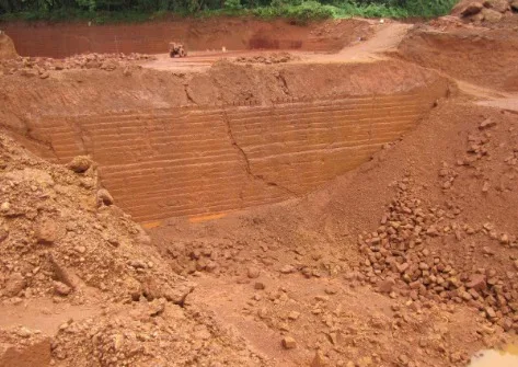
Waste land is the land put to other non-agricultural uses which include rocky, arid and desert areas, roads, railways, industry etc. Continuous use of land over a long period of time without taking appropriate measures to conserve and manage it, has resulted in land degradation.
Land Degradation and Conservation Measures
Human activities such as deforestation, overgrazing, mining and quarrying have contributed significantly to land degradation. Mining sites leave deep scars and traces of overburdening the land. In recent years, industrial effluents as waste have become a major source of land and water pollution in many parts of the country. Some of the ways through which we can solve the problems of land degradation are:- Afforestation and proper management of grazing.
- Planting of shelter belts of plants.
- Stabilisation of sand dunes by growing thorny bushes.
- Proper management of wastelands.
- Control of mining activities.
- Proper discharge and disposal of industrial effluents and wastes after treatment.
Soil as a Resource
Soil is the most important renewable natural resource. It is the medium of plant growth and supports different types of living organisms on the earth.- It takes millions of years to form soil up to a few cms in depth. Various forces of nature, such as changes in temperature, actions of running water, wind and glaciers, activities of decomposers, etc., contribute to the formation of soil.
- Parent rock or bedrock, climate, vegetation and other forms of life and time are important factors in the formation of soil.
- Chemical and organic changes which take place in the soil play an important role.
- Soil also consists of organic (humus) and inorganic materials.
Classification of Soils
On the basis of the factors responsible for soil formation, colour, thickness, texture, age, and chemical and physical properties, the soils of India are classified into different types, as mentioned below.Alluvial Soils
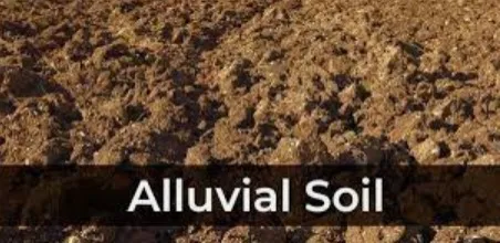
- The entire northern plains are made of alluvial soil.
- The Alluvial Soil is deposited by 3 important Himalayan river systems – the Indus, the Ganga and the Brahmaputra.
- It is also found in Rajasthan, Gujarat and eastern coastal plains, particularly in the deltas of the Mahanadi, the Godavari, the Krishna and the Kaveri rivers.
- The alluvial soil consists of various proportions of sand, silt and clay. As we move inland towards the river valleys, soil particles appear to be bigger in size whereas in the upper side of the river valley, the soils are coarse.
- Based on age, Alluvial soils can be classified as:
- Old Alluvial (Bangar): The Bangar soil has a higher concentration of kanker nodules than the Khadar.
- New Alluvial (Khadar): It has more fine particles and is more fertile than the Bangar.
- Alluvial soils are very fertile. These soils contain an adequate proportion of potash, phosphoric acid and lime, which are ideal for the growth of sugarcane, paddy, wheat and other cereal and pulse crops.
Black Soil
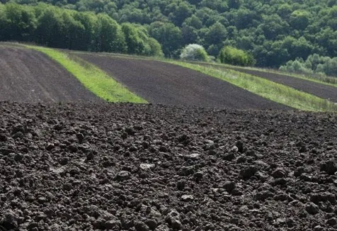
- This soil is black in colour and is also known as regur soil . Climatic conditions, along with the parent rock material are the important factors for the formation of black soil.
- The soil is ideal for growing cotton and is also known as black cotton soil.
- This type of soil is typical of the Deccan trap (Basalt) region spread over the northwest Deccan plateau and is made up of lava flows.
- The soil covers the plateaus of Maharashtra, Saurashtra, Malwa, Madhya Pradesh and Chhattisgarh and extends in the southeast direction along the Godavari and the Krishna valleys.
- The black soils are made up of extremely fine i.e. clayey material and are well-known for their capacity to hold moisture.
- Black soil is nutrients rich and contains calcium carbonate, magnesium, potash and lime.
- The soil is sticky when wet and difficult to work on unless tilled immediately after the first shower or during the pre-monsoon period.
Red and Yellow Soils
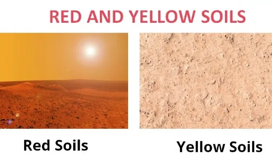
- This type of soil develops on crystalline igneous rocks in areas of low rainfall in the eastern and southern parts of the Deccan plateau.
- These soils develop a reddish colour due to the diffusion of iron in crystalline and metamorphic rocks. It looks yellow when it occurs in a hydrated form.
- Found in parts of Odisha, Chhattisgarh, southern parts of the middle Ganga plain and along the Piedmont zone of the Western Ghats.
Laterite Soil
- The laterite soil develops under tropical and subtropical climates with the alternate wet and dry season.
- This soil is the result of intense leaching due to heavy rain.
- Lateritic soils are acidic (pH<6.0) in nature and generally deficient in plant nutrients. This type of soil is found mostly in Southern states, Western Ghats region of Maharashtra, Odisha, some parts of West Bengal and the northeast regions.
- The soil supports deciduous and evergreen forests but humus poor.
- This soil is very useful for growing tea and coffee.
Arid Soils
- Arid soils range from red to brown in colour.
- This soil is generally sandy in texture and saline in nature. In some areas, the salt content is very high and common salt is obtained by evaporating the water.
- Arid soil lacks humus and moisture.
- The lower horizons of the soil are occupied by Kankar because of the increasing calcium content downwards. The Kankar layer formations in the bottom horizons restrict the infiltration of water.
Forest Soils
- These soils are found in the hilly and mountainous areas.
- The soil texture is loamy and silty on the valley sides and coarse-grained on the upper slopes.
- In the snow-covered areas of the Himalayas, these soils experience denudation and are acidic with low humus content. The soil is fertile on the river terraces and alluvial fans.
Soil Erosion and Soil Conservation
Soil erosion is defined as the depletion of the soil cover and the ensuing washing down. Human activities including mining, overgrazing, construction, and deforestation are to blame for soil erosion. Moreover, soil erosion is caused by a few natural phenomena like wind, glaciers, and water. Farming practices that are not up to par might also lead to soil erosion. The clayey soils are sliced through by the flowing water, creating gullies and other deep channels. The area is referred to as "bad land" after it is unsuitable for farming. Sheet erosion is the process of large-scale, topsoil-eroding streams of water flowing down a slope in a sheet form. Wind erosion occurs when the wind carries loose soil off a sloping or level terrain.Different Ways for Soil Conservation
- Water flow down slopes is slowed by ploughing along contour lines. We refer to this as contour ploughing.
- Erosion is limited through terrace cultivation. The Western and Central Himalayas are home to this kind of agriculture.
- when a sizable field is split into strips and grass is allowed to grow in between the rows of crops. The wind's force is then reduced as a result. We call this technique "Strip Cropping."
- Stabilising the desert in western India and stabilising sand dunes are achieved through the planting of rows of trees to provide shade. These tree rows are referred to as "Shelter Belts."
CBSE Class 10 Social Science Geography Notes Chapter 1 FAQs
What is the 1st chapter of geography class 10?
What are the notes of black soil Class 10?
Who is the father of geography?